

Our towns

Lake Grace
LAKE GRACE is an attractive Wheatbelt town with a community of approximately 548 people. The town is the largest in the shire and the council office is located here. Visit our beautiful swimming pool in the summer months, sample wines at a local vineyard, or stock up on supplies in town.
Land was first selected by the Lands Department in 1907 and the town was named for the two large interconnected salt lakes 8 kms west of the town. The belts of heavy timber were eagerly sought because of their fertility and the reliable climate for wheat growing. In 1916 the railway line reached Lake Grace, providing a vital link for food and general supplies, and a regular mail service.
If you are in need of some inspiration have a look at our Historical Mural in the centre of town. The mural features women who in some way were pioneers of the district, from European settlement to the present. Panoramic views of our immense lake system can be seen from the Lake Grace Lookout, 12 kms west of town. Lake Grace is 50.5 kms long and up to 7.25 kms wide. It has been estimated that 19 million tonnes of gypsum lie under the salty surface.
Lake Grace Lions Park at the eastern entry to town and Apex Park on the western outskirts are both ideal for rest breaks and picnics. There are also a number of small parks within the townsite.

Newdegate
Stay a while in the town of Newdegate which lies at the centre of the shire. Newdegate was settled in 1922 and the railway line was extended from Lake Grace in 1926. By 1928, Newdegate had four general stores, a hotel, baker, saddler, two garages, fruit shop and a town hall. Today the town, though smaller, is a self-sufficient farming community which hosts one of the State’s major agricultural events – Newdegate Machinery Field Days.
The Field Days are held on the first Wednesday and Thursday of September each year, with over 300 exhibitors and between 9,000 and 11,000 visitors annually.
Machinery, technology and research, animals and livestock, outdoor and camping exhibits, arts, fashion, show-bags, food and wine, local produce, live entertainment and much more form the basis of the two day event, which promotes and celebrates innovation in agriculture. From the first Field Days in 1973, this event has grown to be one of the most recognised on the Western Australian agricultural calendar. Catch up with tourism information at the Pioneer Park gazebo in the town centre, or relax in the park gardens with barbeques for public use.
While you’re in the area, come into the Newdegate Community Resource Centre to check your email.
The Hainsworth Building, which houses the Newdegate Pioneer Museum, was originally built as a general store and dining room in 1931/2. The heritage listed building also functioned as a boarding house for railway workers and travellers.
Come in to the museum and see a fine collection of photographs, historical objects and musical instruments from times of early settlement. Wander outside to see examples of early agricultural machinery.

Lake King
Travel east along the fascinating Lake King Causeway as you cross 10 kms of salt lakes studded with natural scrub and wildflowers. Take time to enjoy the scenery along the longest WA road built across a salt lake.
The settlement of Lake King, Lake Camm, Varley and Mount Madden during 1928 was to be the start of a vast 3400 farms scheme that extended to Salmon Gums. The Great Depression saw the British government withdraw from this land settlement scheme and the land was condemned for salinity. However a group of settlers remained and the area is now a productive farming community.
Lake King Progress Association has worked to improve the community since 1930 and many of the facilities are created through their initiative. Drive down the Magdhaba Track to Roe Hill Look-out through a conservation reserve of native fauna. The Norseman Road from Lake King to the east passes through the Frank Hann National Park (61,420 hectares) at the eastern end of the shire boundary. Another magnificent tourist attraction on the eastern end of the Norseman Road is Peak Charles, which rises 480 metres above the surroundings.tel nearby. Lake King has a very attractive stone fronted Community Church and a tavern built locally from rammed earth with a motel nearby.
Varley
Varley was established in 1939 and now has a population of approximately 50 living within the town and district. The town has a comprehensive museum (Seward Avenue) with fine displays of memorabilia and historic town records. Locals and visitors can play lawn bowls, netball and tennis at the Recreation Centre or chase the white ball around the 18-hole golf course.
The well-equipped Medical Centre has regular visits from the Royal Flying Doctor Service from Kalgoorlie, establishing a lifeline for the more isolated communities.
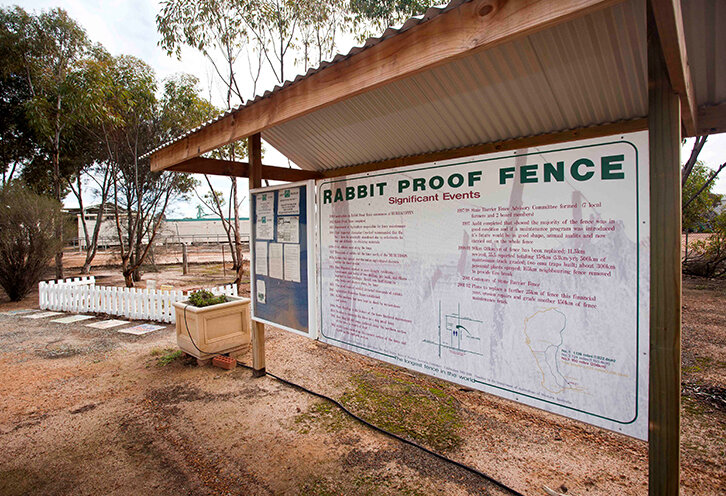
Travel from Varley to Hatters Hill or to the historic Rabbit Proof Fence that skirts the eastern end of the shire.
Gold was discovered at Hatters Hill in the early part of the twentieth century. The small settlement (1930-1944) is now uninhabited and an interesting spot for fossickers. Profitable quantities of gold were also mined and processed at Griffin’s Find near Lake Grace before its closure in the late 1980’s.